Northside Final Masterplan
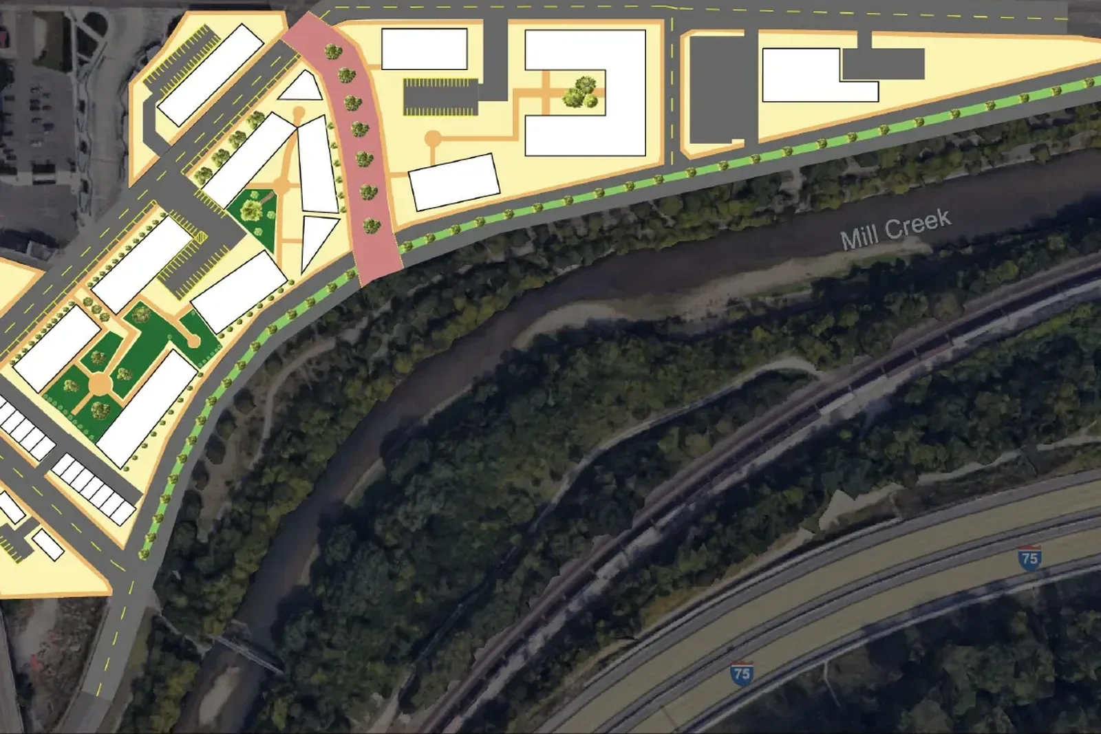
A mixed use residential extension of Hamilton Avenue on 7.8 underused acres between the Northside Transit Center and the Mill Creek greenway, with about 204 homes and 20,000 square feet of retail.
- Role
- Solo. Site analysis, concept plan, masterplan, focus area site plan, sections, 3D model, collages, and proforma
- Timeframe
- Fall 2025 · Studio, 15 weeks
- Location
- Northside, Cincinnati, Ohio
- Tools
- Adobe Illustrator
- SketchUp
- Photoshop
- Excel
The site
Northside has one of the strongest main streets in Cincinnati, and right next to it is a stretch of land that mostly sits empty. The study area runs between Hamilton Avenue, Spring Grove Avenue, and the Mill Creek, a few steps from the Northside Transit Center. Compared with the blocks around it, the site is barren. Industrial uses sit almost directly against the main street, the transit center faces empty lots, and the only real green space nearby is carried by the Mill Creek Greenway.
The studio started as a team context analysis with Jackson and Diego, where I worked out an early concept I called the Northside Yard. The final masterplan, focus area plan, sections, model, and proforma were my own work in the second half of the term.
Vision
A mixed use residential extension of Hamilton Avenue.
Instead of letting the main street stop at the transit center, the plan continues it across the site: buildings that hold the street edge, a walkway through the middle, and housing above shops so people are around all day. Green space is grouped into usable pieces instead of leftover strips. The walkway, the plaza at the transit center, and the greenway edge give the place its identity.
Focus area
The focus area is the roughly 7.8 acre block closest to the transit center. I drew it at site plan scale with separate layers for land use, parking, and open space, so each decision could be checked on its own.
- Land use: residential along the greenway side, mixed use toward Hamilton Avenue, a small commercial corner, and the existing industrial edge kept where it is.
- Parking: 120 spaces, tucked behind and under buildings so the walkway and the street frontages stay for people.
- Open space: a public open space at the center, community open space shared by the residential buildings, and private courtyards, with sidewalks drawn separately from general hardscape so the plan is easy to read.
Sections, model, and collages
Sections through the focus area and along Spring Grove Avenue check the building heights against the street width, and a SketchUp model gives the walkway and the courtyards a sense of scale. The collages put a coffee shop and an apartment entry on the central walkway to show what the plan would feel like on foot.
Proforma
Numbers from the proforma:
- Site area of about 7.8 acres and about 240,000 square feet of building.
- About 204 homes: roughly 120 one bedroom apartments, 70 two bedroom apartments, and 14 two story townhomes.
- About 20,640 square feet of retail, planned as coffee, restaurants, and a combined cafe and nightclub to keep the walkway active into the evening.
The full deck
The final presentation, start to finish. Click any slide to enlarge it, or open the PDF from the links above.